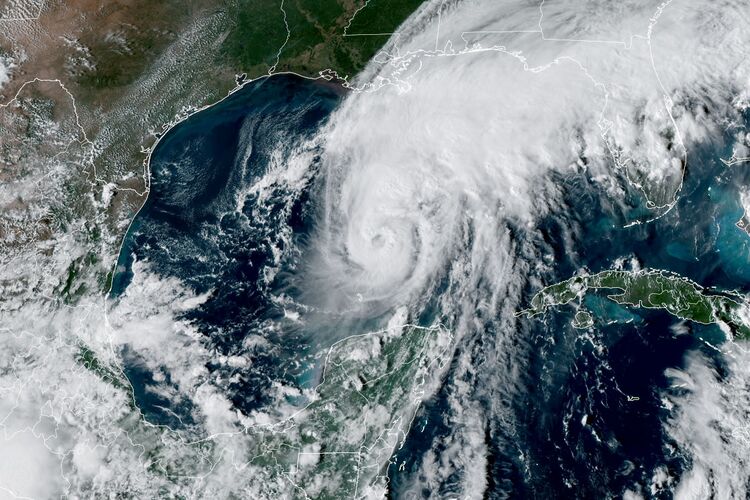
Hurricane Isaias strengthened into a major storm Friday as it barreled toward more than 3 million people along the US Gulf Coast, threatening dangerous flooding and storm surge after forcing energy producers to curb output.
Isaias’ top winds reached 120 miles (193 kilometers) per hour, making it a Category 3 storm on the five-step Saffir-Simpson scale, the US National Hurricane Center said in an advisory at 11 a.m. New York time. The storm was about 195 miles south of Pensacola, Florida.
The hurricane is expected to make landfall late Friday or early Saturday along the Alabama-Florida coast. Storm surge and tropical storm warnings extend west into Louisiana. Shore-based radar can now see Isaias’ eye, so the hurricane center will begin issuing hourly updates.
In addition to its damaging winds, Isaias is forecast to push as much as 9 feet (3 meters) of water ashore, the center said.
“This is a life-threatening situation,” Robbie Berg, a warning coordination meteorologist at the center, wrote in his outlook. “Persons located within these areas should take all necessary actions to protect life and property from rising water and the potential for other dangerous conditions.”
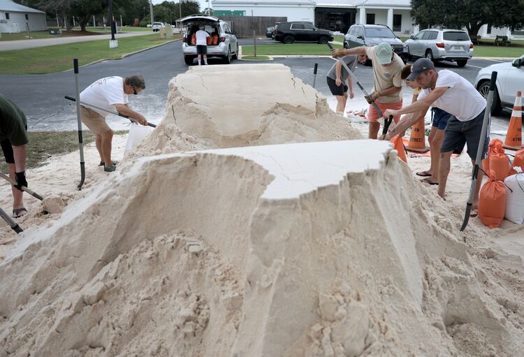
Isaias helped push US oil prices up as much as 5.6% on Thursday as companies evacuated crews from platforms and moved drilling rigs out of the storm’s path. Roughly 63% of US Gulf of Mexico crude output has been shut in , while nearly 500,000 barrels a day of refining capacity lies in or near the storm’s projected path. Several ports are also shutting ahead of the hurricane, disrupting seaborne crude deliveries.
Three fuel-making facilities are in or near the projected path, including Chevron Corp.’s 356,000 barrel-a-day refinery in Pascagoula, Mississippi. Even small production losses could trigger sharp price increases, with US gasoline and diesel stockpiles already far below seasonal norms. Natural gas production in the Gulf has also fallen, with about 57% of regional output shut in.
Read More: Atlantic Hurricane Season at Most Tranquil Since 1941 on El Niño
Still, Isaias’s shift east has limited the hit to Gulf oil, gas and LNG facilities compared with earlier forecasts, even as the storm intensified, according to Gary Cunningham at Tradition Energy.
“Isaias is remaining stronger than originally projected but its track is more east,” Cunningham said in an email, limiting the impact on Gulf production and LNG export facilities.
Natural gas futures fell Friday as traders weighed the production losses against the potential for storm damage to curb regional energy demand. November gas was trading near $3.14 per million British thermal units Friday morning, after settling at $3.168 Thursday.
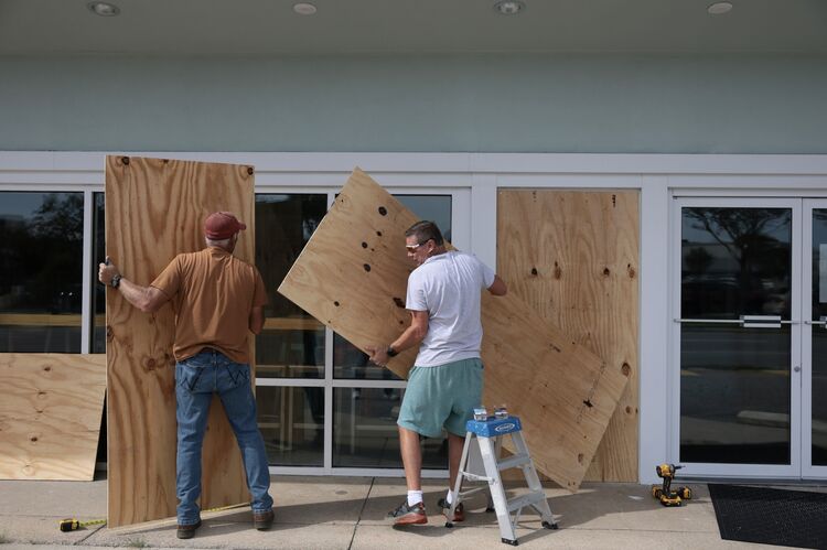
Florida suspended tolls on bridges in Okaloosa and Santa Rosa counties to help people evacuate, while Governor Ron DeSantis declared a state of emergency in 27 counties.
After coming ashore, Isaias is forecast to race across Alabama and into the Tennessee and Ohio valleys, bringing as much as 8 to 12 inches of rain, said Tyler Roys, a meteorologist with commercial forecaster AccuWeather Inc.
On the storm’s eastern side, as much as 8 inches may fall across parts of the Carolinas, including areas devastated by flooding from Hurricane Helene in 2024.
Duke Energy’s Florida utility said workers are ready to respond to outages. “Our crews are prepared to restore power as soon as conditions allow,” said Todd Fountain, the utility’s storm director.
Reaad More: El Niño and Heat Fuel Destructive Storms Across Pacific
At the same time, Tropical Storm Rachel is forecast to strike northern Baja California late Saturday, sending heavy rain and damaging wind gusts into Southern California, Arizona and as far north as Salt Lake City, Utah, Roys said. A shift in the track could bring the storm closer to San Diego, which would be a rare event.
Further south, more powerful Hurricane Simon, with top winds of 100 mph, is forecast to possibly reach Category 4 strength Saturday as it nears landfall in Jalisco and Colima, potentially threatening the key port of Manzanillo, Mexico’s busiest Pacific port. In addition to container cargoes and shipping to Asian markets, Manzanillo also hosts a key LNG import terminal, fuel storage terminals and a number of power plants.
Heavy rain from Simon has already caused havoc in the Mexican state of Guerrero, with residents in several cities suffering electricity outages yesterday, according to state utility Comision Federal de Electricidad. As of Friday morning, CFE had restored about 90% of electricity in the affected area, the power company’s head Emilia Calleja said in a press briefing.
Sign up for the Weather Watch newsletter — tracking the market, business and economic impacts of extreme weather with Bloomberg.