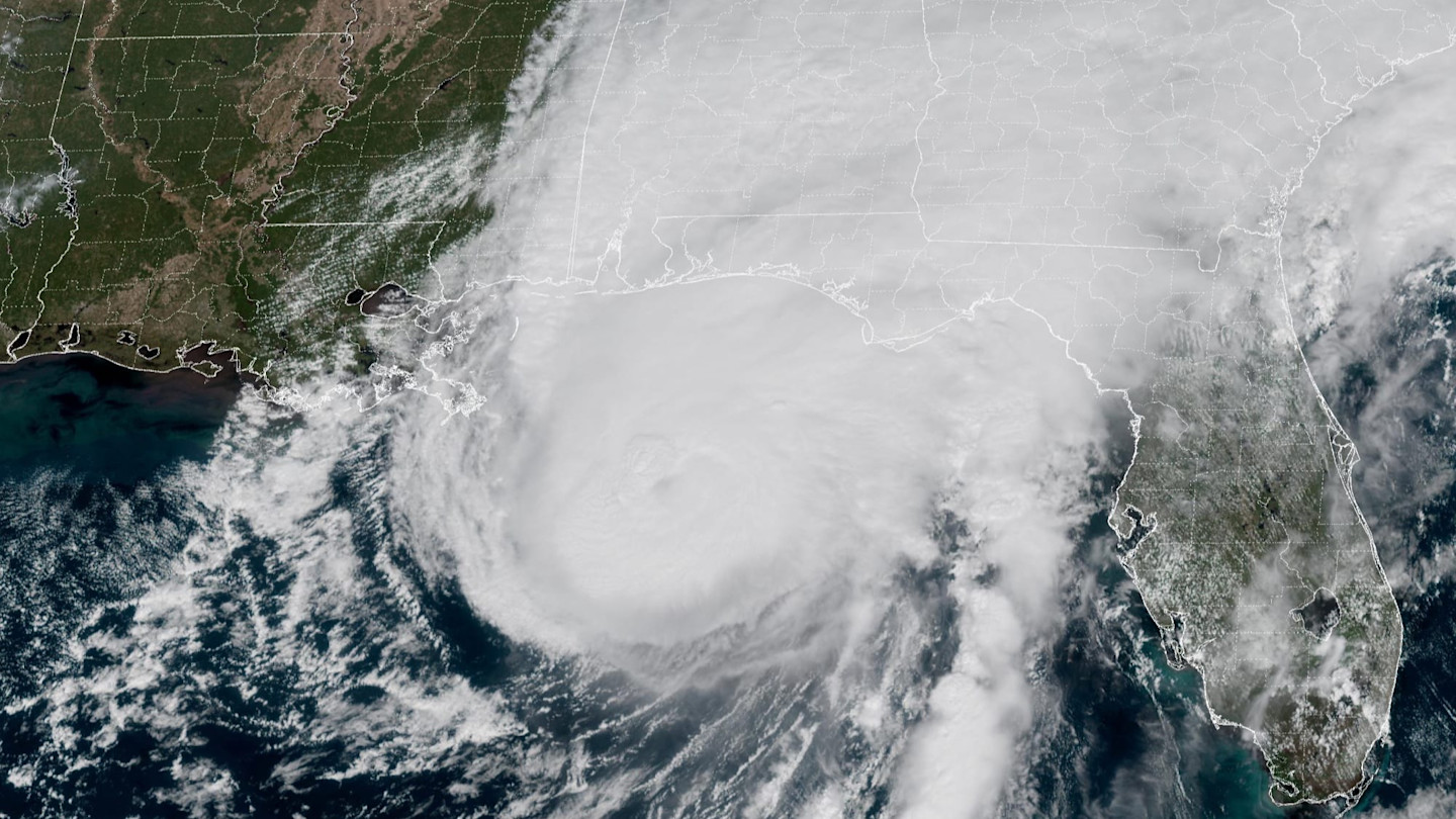
Oil and gas production in the Gulf of Mexico was disrupted and more than 800,000 households across three states were without power early on Saturday after Hurricane Isaias made landfall on the Florida coastline.
The storm brought top winds of 105 miles (169km) an hour before weakening into a tropical storm as it made its way inland, the US National Hurricane Center said. Power lines were knocked out in Florida, Alabama and Georgia.
Energy majors including Chevron evacuated offshore platforms and shut operations in advance of the hurricane as it approached on Friday.
Workers were evacuated from more than 100 oil and gas platforms and more than half of all offshore production in the Gulf was paused ahead of the arrival of Hurricane Isaias.
The US Marine Minerals Administration said on Friday that evacuations had taken place at 129 of the 371 manned platforms, halting about 70 per cent of the daily oil production.
Experts expected little immediate effect on already high oil prices, unless the hurricane power outages affected oil refineries.
Video description
Animation of Hurricane Isaias developing in the Gulf of Mexico
The US National Weather Service issued surge warnings early on Saturday and forecast heavy rainfall would spread into the south-east through the weekend. A risk of tornadoes would persist across parts of the eastern Florida Panhandle, Georgia, and the Carolinas, it added.
Isaias became the first tropical storm to develop into an Atlantic hurricane this year, marking the latest arrival of the season since 1905.
It is also the first hurricane to hit the eastern US since Milton in 2024, which was the previous hottest year on record as the global temperature rise caused by climate change combined with the naturally occurring effects of the El Niño warming cycle of the Pacific Ocean.
Some content could not load. Check your internet connection or browser settings.
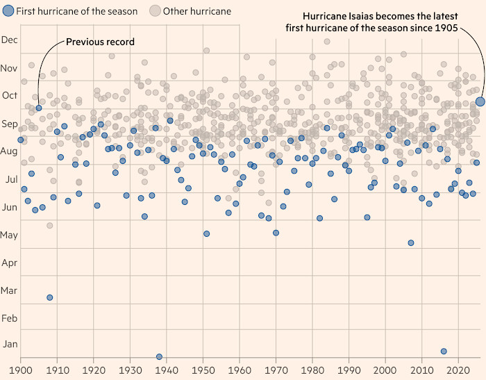
Typically, hurricane activity reaches a peak in September in the Atlantic region. But the warming phenomenon in the Pacific Ocean alters the atmospheric conditions there to lessen the ability of tropical storms to form into a hurricane.
An increase in vertical wind shear in the Atlantic, blowing at varying speeds and high altitudes, makes it harder for the storms to organise into hurricanes.
Conversely, El Niño increases the hurricane conditions in the Pacific as the warmer waters provide more energy to storms.
The World Meteorological Organization said in its latest update that sea-surface temperatures in the central and eastern tropical Pacific were forecast to increase to record levels as the El Niño phenomenon builds to year end.
The rise in sea surface temperatures could reach some 3.7C above average, peaking around December. This would be the highest since modern satellite observations.
Where climate change meets business, markets and politics. Explore the FT’s coverage here.
Are you curious about the FT’s environmental sustainability commitments? Find out more about our science-based targets here